
Map of the Week: Genève transit simulator
Thursday, April 18, 2013
Why we like it: The Genève transit simulator uses Google Maps to simulate the movement of the various transit networks run by TPG in Genève (Geneva).

The map uses Symbols on Polylines to display the predicted motion of the tram or bus. It uses a ‘mouseover’ event on each of the markers to open an div element displaying more information.
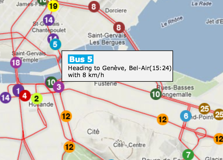
This map was produced during the Urban Data Challenge by Robert Ille. It’s a nice demonstration of the power of our Symbols on Polylines and the power of public data in conjunction with maps.

